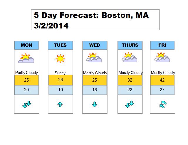
A massive upper-level low continues to wobble around southeast Canada which will help support below average temperatures for the majority of the next 5 days. Perhaps by Friday temperatures will climb closer to normal values for early March.
Boston did manage to reach 40 degrees today but it was brief as most of today was spent in the 30s. An easterly wind direction in place now will switch over to a more northerly wind direction so I expect temperatures to be near 20 by Monday morning. A round of light snow is possible overnight with a coating possible.
850mb temperatures for Monday will be around -15C, combined with a northerly flow and high clouds, will prevent temperatures from rising much from the Monday morning low. Wind chills will be in the teens. A cold night is expected Monday night.
High pressure builds in for Tuesday, which will promote plenty of sunshine and less wind. However 850mb temps still running around -15C so high temperature will be in the 20s. Wednesday is still cold with more clouds around and a light northerly flow.
I am watching an ocean storm towards the end of the week, but for now that looks to stay out at sea. Either way cold air begins to retreat after midweek.