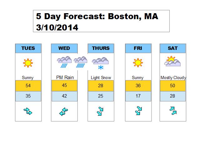
This week will feature quite the roller ride with temperatures and a coastal storm.
Boston has managed to climb to the middle 40s on this Monday afternoon despite the abundant clouds in place. These clouds won’t be around for Tuesday so I expect a warmer day with temperatures in the middle 50s. A similar day to this past Saturday.
Then we turn our heads to an approaching storm on Wednesday. A large surge of warm air and moisture ahead of it will result in a swath of rain Wednesday afternoon and into the night. Once the area of low pressure is to our east, and more northerly flow will develop and temperatures will plummet. This puts us at early Thursday morning where it will be cold enough for snow. However it is difficult to tell how much precipitation will be around at this time. A quick couple of inches is possible, but not certain on that.
Thursday will be a cold day as a piece of arctic air will be in place and I don’t think we will be seeing the sun at all. Thursday afternoon is dry. This arctic air lifts out for Friday as temperatures climb closer to average. Mild weather returns for Saturday with a developing southwest flow.